SMART ENGINEERING SOLUTIONS
GROUND PENETRATING RADAR
Ground-penetrating radar (GPR) is a geophysical method that uses radar pulses to image the subsurface. It can be used to detect objects, changes in material properties, and variations in soil properties. GPR can be used to map subsurface features such as buried utility lines, cavities, and foundations, as well as to investigate soil and rock properties. The technology is based on the principle of radar, which uses electromagnetic waves to image subsurface features. GPR systems typically consist of an antenna, a transmitter, and a receiver, as well as a data acquisition and processing system. The antenna emits a pulse of electromagnetic energy, which travels through the soil and reflects off subsurface features. The receiver detects the reflected energy and uses it to generate a subsurface image.


SURFACE WAVE
MASW (Multichannel Analysis of Surface Waves) theory is a method used to measure the subsurface shear wave velocity (Vs) profile of the ground. It is a non-invasive and cost-effective method that uses surface waves to study the subsurface. The MASW method involves the use of a linear array of geophones or accelerometers to measure the surface wave velocities at different points along the surface. The data collected is then used to create a Vs profile of the subsurface. One of the main advantages of MASW is that it can be used in a wide range of soil conditions, including soft soils, rocky terrain, and even in urban environments. It can also be used to study the subsurface at various depths, from shallow depths to depths of several hundred meters. The MASW method is commonly used in civil engineering, geotechnical engineering, and environmental engineering to study the subsurface for a variety of applications, including site characterization, soil liquefaction assessment, and slope stability analysis. Overall, MASW theory provides an efficient and effective way to study the subsurface and can provide valuable information for engineers and scientists working in various field

ELECTRICAL RESISTIVITY TOMOGRAPHY
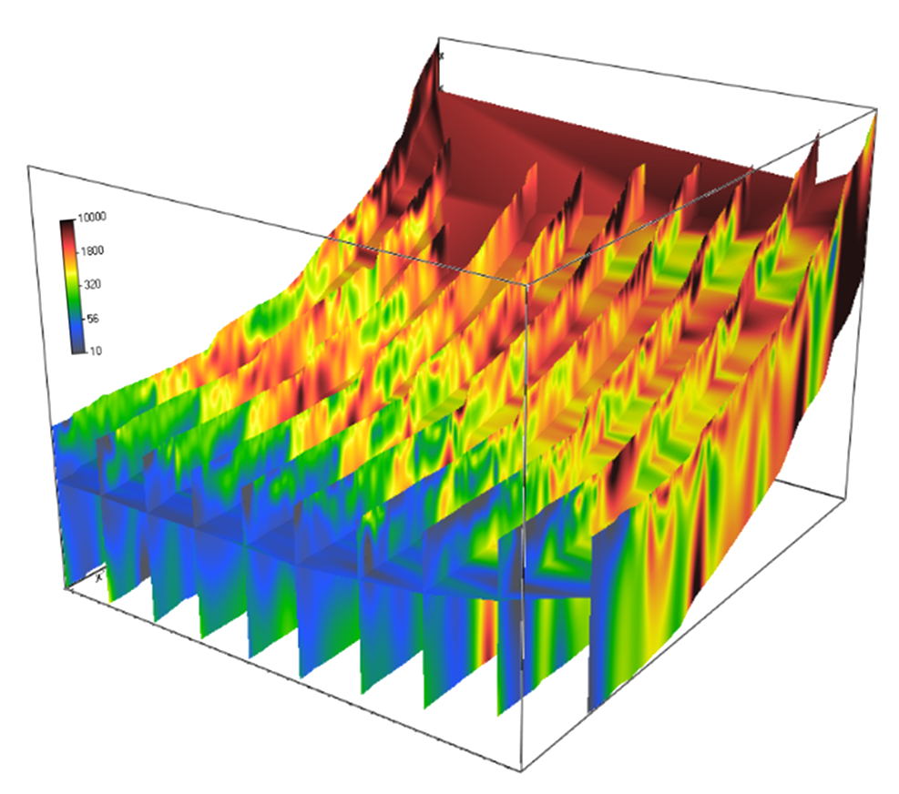
ERT (Electrical Resistivity Tomography) is a geophysical method that uses electrical current to image subsurface structures and variations in electrical resistivity. It is commonly used in groundwater exploration to map subsurface geology and identify potential aquifers. The theory behind ERT is based on the principle that subsurface materials have different electrical resistivities. For example, sand and gravel have a lower resistivity than clay or rock. By injecting a small electrical current into the ground and measuring the resistance at various points, scientists can create a resistivity map of the subsurface. ERT is particularly useful for identifying aquifers because the presence of water increases the electrical conductivity of a subsurface material. This means that areas of high conductivity on the resistivity map are likely to be areas with a high water content, and therefore potential aquifers. ERT can also be used to identify other subsurface features, such as fractures or faults, which can also affect the flow of groundwater. Overall, ERT is a valuable tool for groundwater exploration and can help identify potential aquifers, as well as other subsurface features that may affect the flow of groundwater.

LET'S GET STARTED ON YOUR PROJECT RIGHT NOW!
Our main focus is client satisfaction. Get in touch with the HUB Geoservices Group for more information.
Multifunctional, independent, technology-based service company. Leading, innovative, fully integrated in the petroleum and hydrogeology industries. We also offer a variety of convenient delivery alternatives, including in-house and public training to combine training with premium venues throughout the world.
QUICK LINKS
USA OFFICE
All Rights Reserved | HUB Geoservices Group

